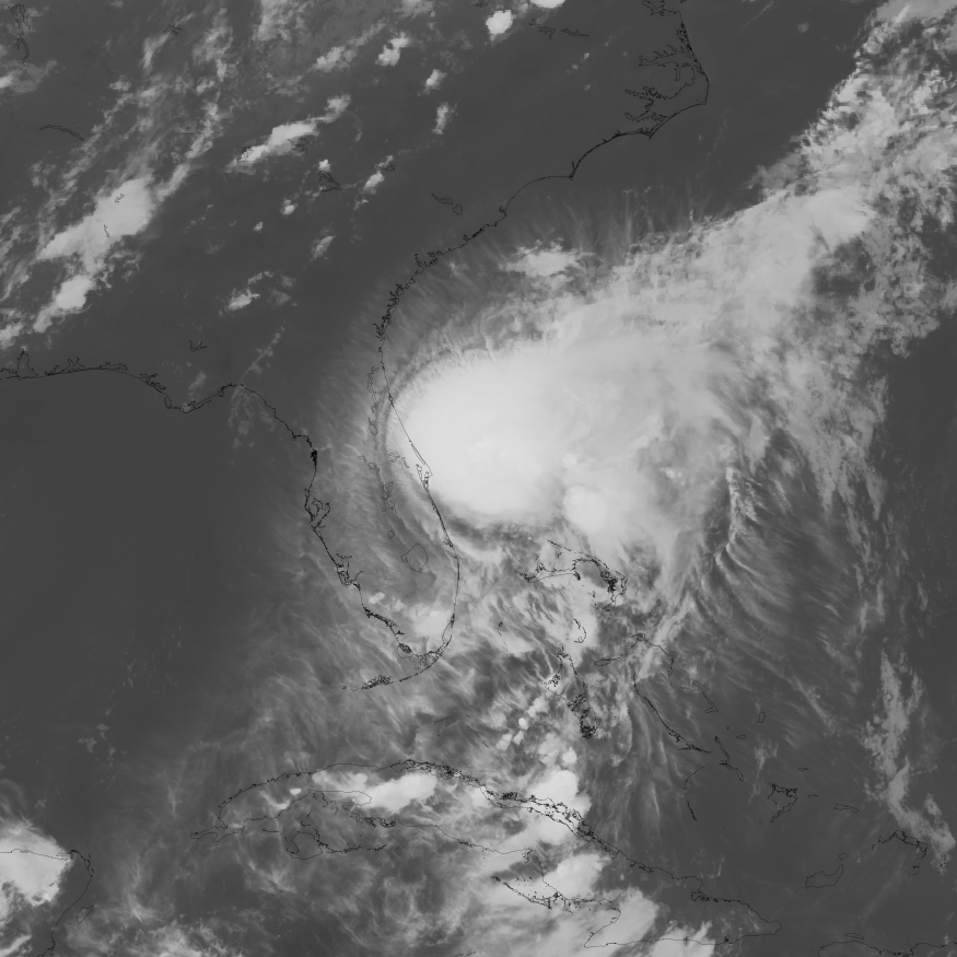
Tropical Storm Isaias strengthened to 65 mph Wednesday evening, Oct. 7, as forecasters warned that the system could become a powerful hurricane before reaching the northern Gulf Coast late Friday or early Saturday.
Although the storm's projected path remains well west of Clay County, residents in Orange Park and Fleming Island face another round of heavy rain and possible flooding after days of wet weather.
The National Hurricane Center upgraded the system from Tropical Depression Nine to Tropical Storm Isaias early Wednesday, when maximum sustained winds reached 40 mph about 285 miles west of Progreso, Mexico.
By Wednesday evening, sustained winds had increased to 65 mph. Forecasters projected Isaias could reach 110 mph over the Gulf before weakening somewhat as it approached land.
The storm's effects could extend far beyond its center, with heavy rainfall expected across portions of the Southeast from Friday through the weekend.
Clay County faces flooding concerns after days of rain
Orange Park and Fleming Island residents are already dealing with saturated ground following a nor'easter that brought persistent rain to Northeast Florida.
News4Jax reported Sunday, Oct. 4, that several days of rainfall had left soils saturated across the Jacksonville area.
The National Weather Service in Jacksonville forecast additional showers and thunderstorms through Saturday, with breezy conditions Friday and Saturday.
The Wednesday evening forecast gave Orange Park an 80% chance of rain Friday and a 90% chance Saturday.
Flooding along the St. Johns River presents another concern.
The Weather Service issued a Coastal Flood Warning for portions of the St. Johns River basin through 5 p.m. Thursday, Oct. 8, followed by a Coastal Flood Advisory extending into Saturday.
Persistent onshore winds and high astronomical tides could produce repeated flooding around high tide, particularly in low-lying waterfront areas.
News4Jax reported Tuesday that water levels could rise 1.5 to 2.5 feet above normally dry ground in vulnerable locations.
The coastal flooding is associated with the ongoing onshore wind and tidal pattern, rather than solely with Isaias.
Hurricane forecast calls for 110 mph winds
The National Hurricane Center's Wednesday forecast projected Isaias could reach maximum sustained winds of 95 knots, approximately 110 mph, by Friday.
That would make the system a Category 2 hurricane on the Saffir-Simpson Hurricane Wind Scale.
Forecasters warned that the storm's track remained uncertain, with differences among computer models affecting where its strongest winds and heaviest rainfall could occur.
The projected landfall area includes portions of the northern Gulf Coast, particularly the Florida Panhandle, Alabama and Mississippi.
The NHC warned that Isaias could bring dangerous storm surge and damaging winds to portions of that coastline.
Rainfall could extend much farther inland. The center's Wednesday evening advisory projected 3 to 7 inches of rain, with isolated totals reaching 10 inches, across portions of the central Gulf Coast.
Across much of the Southeast, forecasters projected 1 to 3 inches, with isolated totals up to 5 inches.
Those regional projections do not represent a specific rainfall forecast for Clay County.
Clay County outside state emergency declaration
Gov. Ron DeSantis declared a state of emergency for 25 Florida counties Tuesday, Oct. 6, ahead of the approaching storm, CNN reported.
Clay County was not included in the declaration. Nearby Baker and Columbia counties were among those covered.
The declaration allows state officials to position emergency resources ahead of possible impacts.
No storm-specific statement from Clay County Emergency Management was independently confirmed for this report.
The Clay County All Hazards Preparedness Guide recommends that residents review evacuation zones, register for emergency alerts and maintain disaster supplies.
Residents should:
- Check evacuation zones. Clay County uses zones A through E and additional designations for the North and South Prongs of Black Creek. Mobile and manufactured homes are included in Zone A.
- Register for alerts. Sign up through Alert.ClayCountyGov.com or contact Clay County Emergency Management at 904-284-7703.
- Prepare emergency supplies. Keep at least seven days of drinking water and nonperishable food, including one gallon of water per person per day.
- Review flood insurance. Standard homeowners insurance generally does not cover flood damage. Information is available through FloodSmart.gov or 877-336-2627.
Power outage contacts
Residents can report electrical outages to their utility providers:
- JEA: 904-665-6000
- Clay Electric: 855-939-3840
- Florida Power & Light: 800-468-8243
Residents should continue monitoring the National Weather Service in Jacksonville, the National Hurricane Center and Clay County government for updated forecasts, flood warnings and emergency information.
The storm's projected path and intensity remain subject to change.



.jpg)